Author: Katelyn Wood, Marketing Coordinator
Introduction
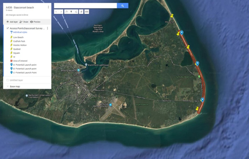
Siasconset is located on the eastern side of Nantucket, Massachusetts tucked against the Atlantic shoreline. This village includes an 80-foot-high coastal bluff that is of concern due to significant erosion that has threatened residences at the top of the bluff. The focus of this project case study is on the bluff that contains a geotube, a series of geotextile tubes filled with sand, that was installed in 2013. The geotube was installed at the base of the bluff by the Siasconset Beach Preservation Fund (SBPF) to provide protection for the bluff. SBPF is a privately funded homeowners association with the goal of preserving the bluff and properties that are along it. The geotube is 800 feet long and consists of four individual 14-foot diameter sections that rest 7 ft high and are stacked in a terrace. The Order of Conditions of the project permit requires that the client conduct quarterly monitoring surveys and submit monitoring reports.