Transportation
Rapid, safe, cost effective. We keep your team out of harm’s way while collecting higher quality data
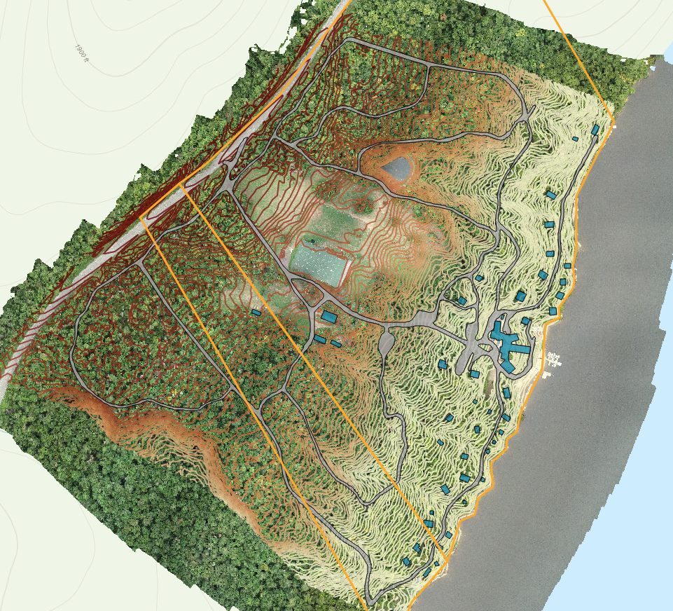
Roads, Rails and Airports
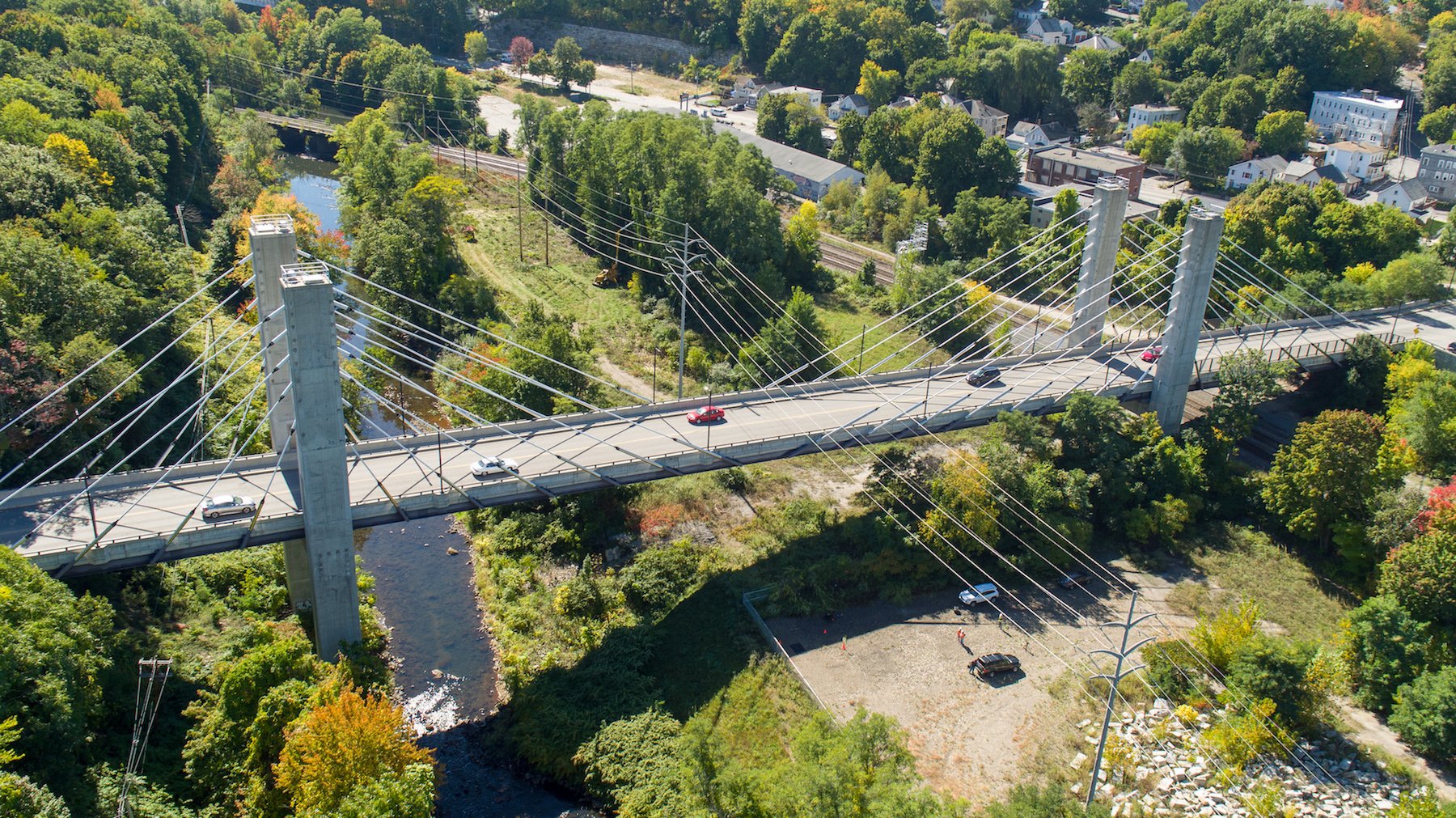
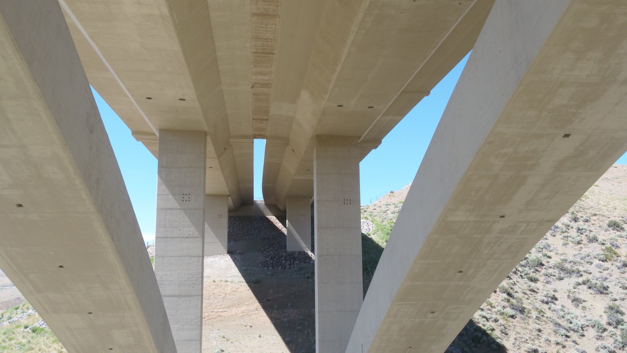
Our complex transportation network, which includes roads, bridges, railroads, and airports, is aging and requires recurrent inspections. Today, many inspections are done with lift trucks, boats and cranes. With UAS, clients are able to safely and efficiently inspect infrastructure such as bridges which have traditionally been difficult to reach.
Roadways and Highways
- Inspection of Highway Bridges
- Traffic Monitoring
- LiDAR Scanning
- Thermal Imaging


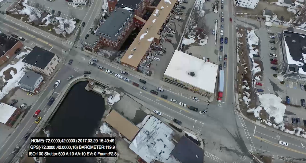
Traffic Study / CCTV
With stationary traffic cameras you can typically only see in one direction at a time. Using a drone and recording high-quality, geo-tagged video we provide clients with a comprehensive view of traffic. In this example we provided several hours of continuous time stamped footage for our client’s to better understand the traffic flow at certain times of the day.
Airports
- Runway Pavement Inspections- This interactive swipe map, displays the high resolution of the drone data collected. At this resolution cracks in the runway can be mapped, quantified and used for change detection.
- Runway Approach Path Obstruction Analysis– LiDAR scan allows you to determine what trees are penetrating the approach path.