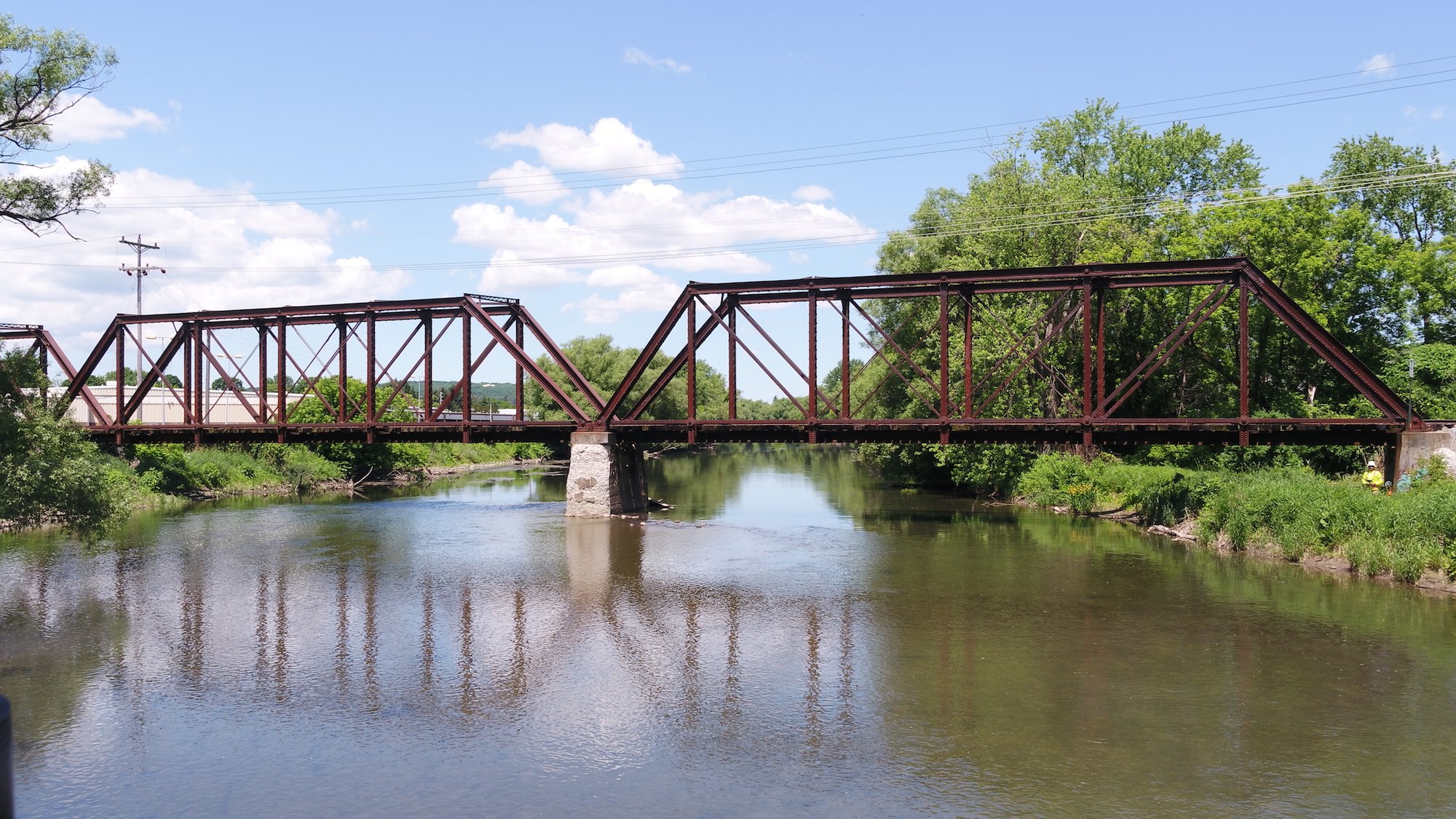
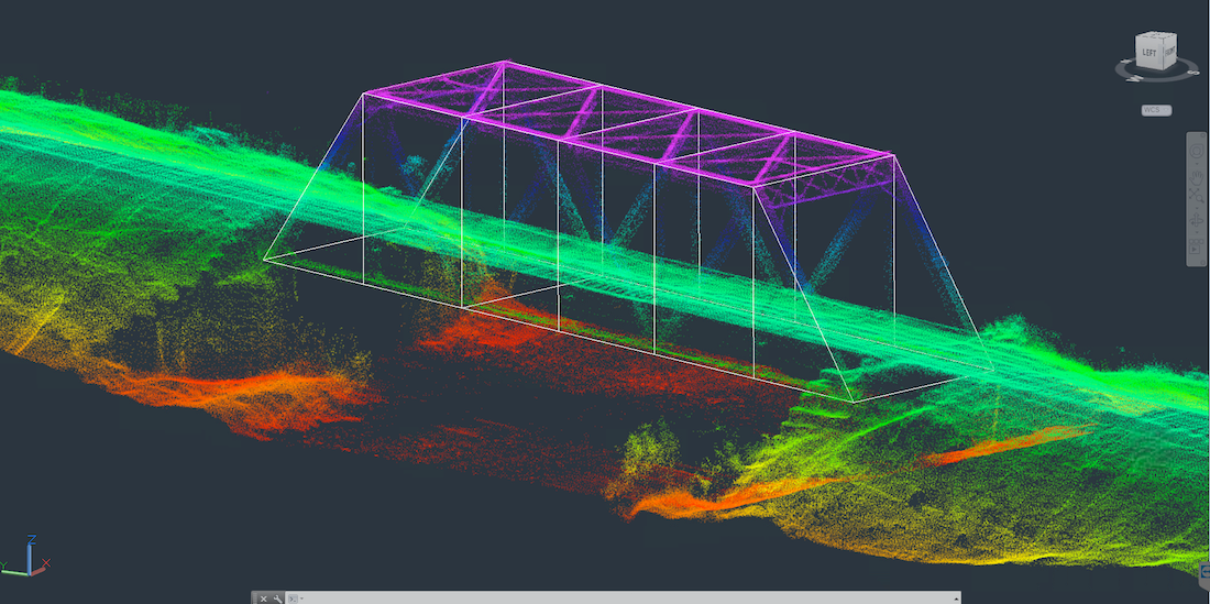
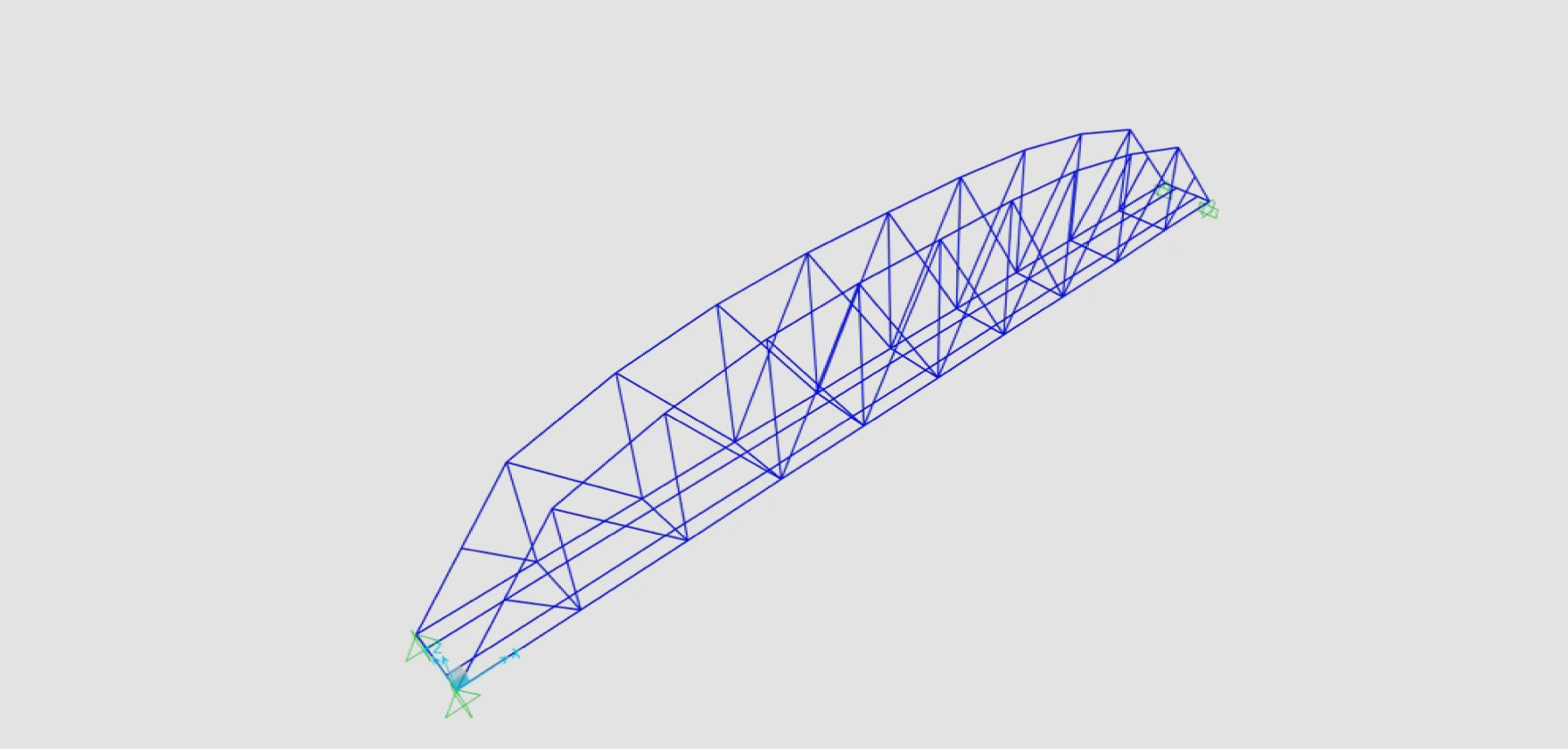
Engineering ⋅ UAS ⋅ Software

The intelligence you need to make informed decisions®

View Full Video

Clients We Serve


  Engineering

ARE manages clients’ infrastructure assets through inspection, rating, and design. Experienced professional engineers oversee and coordinate repair, rehabilitation and design plans with the engineering team. ARE is committed to delivering cost-effective solutions to the client.

UAS Solutions

When it comes to inaccessible or dangerous to access structural assets, our drone (UAS) services are the answer. We specialize in surveying, mapping, monitoring, data collection, and infrastructure inspections, all conducted in a safe, cost-effective, and expedient manner. Our UAS services team is comprised of skilled FAA Part 107 certified pilots, data processors, Geographic Information Systems (GIS) specialists, and engineers.


  Software

AREview White Logo

AREview™ brings Rail Management and Project Management into the digital age. AREview™ is a software suite consisting of a Rail Management Portal and a Project Management Portal. This software is designed to improve overall project management workflow, collaboration among stakeholders, organization, document accessibility, and transparency. AREview™ is The Intelligence You Need to Make Informed Decisions.®

Markets We Serve

Railroad bridge inspection with train on bridge ARE UAS Services
Rail
In-depth Railroad Industry Knowledge, Customized Solutions, Innovative Delivery
Roof top solar array inspection, ARE UAS Services
Energy
Generation, Transmission and Distribution, Storm Damage Assessment, Rapid Response
Drone mapping, Truro, MA coastal erosion monitoring, ARE UAS Services
Environmental
Ecological Monitoring and Mapping, Stormwater Management Support, Coastal Drone Data Collection
Airport runway approach, ARE UAS Services
Transportation
Quick, safer, cost effective
Cell Phone tower inspection, aerial photo, ARE UAS Services
Telecommunications
Get the data you need, while keeping your team safely on the ground
Aerial photograph of Yale University, Divinity Campus by AirShark UAS Services
Institutions
Industrial Campus Scanning, for architectural planning, map development, marketing
construct site aerial photo from ARE's UAS services
Construction
Commercial buildings, aggregate sites, landfills, post-construction inspection

Interested in How to Improve Your Return on Investment?

Our outside-the-box approach to solving engineering and data collection challenges results in impactful solutions.